Steelhead Falls Trail
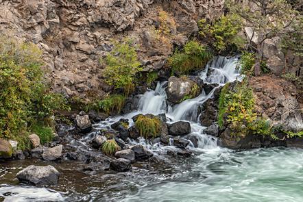
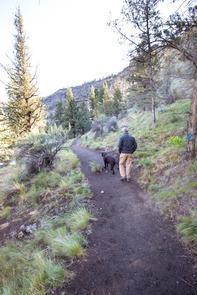
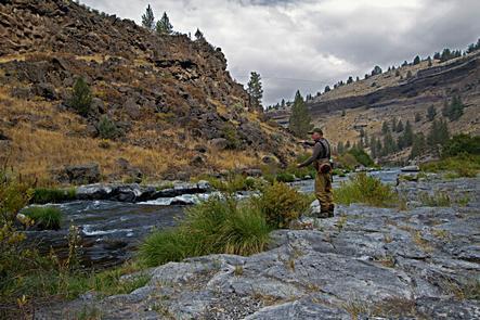
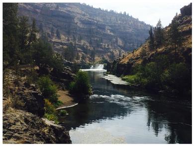
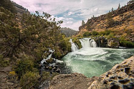
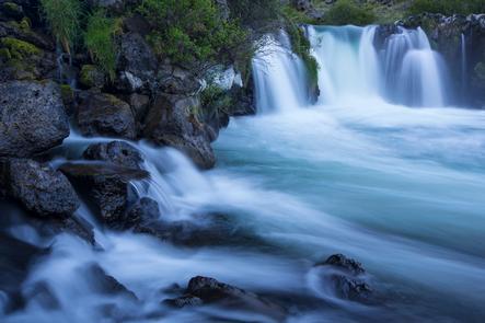
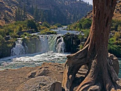
Overview: In steps, it is only about .5 miles from the trailhead to Steelhead Falls. In terms of geologic time, it is a few million years. Colorful grooves decorate cliffs and show the erosion of time. Wildflowers dot the slopes in the spring and golden eagles soar overhead. The trail to the falls is relatively easy, with one small, steep section. Hike down for a picnic, fish in the Deschutes River, explore the rocky shores, or just sit and relax and let the sound of the falls erase the world around you. The Deschutes Canyon-Steelhead Falls Wilderness Study Area (WSA) (OR-5-14) is part of a larger study area that includes U.S. Forest Service lands. This WSA is located in a triangle formed by the towns of Madras, Redmond and Sisters, in Central Oregon. The Steelhead Falls study area is a long narrow area located along the upper Deschutes River, within and adjacent to the U.S. Forest Service-administered Crooked River National Grasslands. Know Before You Go: Open YEAR ROUND. Open for overnight camping, sites are first come first served. Amenities include limited trailer parking and an outhouse, but no potable water. Campfires are allowed; fire restrictions are in effect in the summer. Pets should remain under owner control at all times and leashed at the trailhead and in the camping area. Watch where you put your feet and hands, rattlesnakes can hide around rocks and under brush! Point of Interest: Need more trail time before heading home or setting up camp? Take the Foley Waters trail off the south end of the Steelhead Falls parking lot for some more views! Steelhead Falls Brochure Explore Oregon Recreation: Steelhead Falls
From Redmond, head north on Hwy 97 to Terrebonne and turn west on NE Lower Bridge Way. Go two miles and take a right on NW 43rd Street. Follow that 1.8 miles to Chinook Drive. Go almost a mile and take a left onto Badger Road. Travel one mile and turn right on Quail Road. Follow Quail Road for .5 mile and take a left on River Road. Take River Road downhill to the Steelhead Falls Trailhead and campground.