Sandstone cliffs, beaches, waterfalls, sand dunes, inland lakes, deep forest, and wild shoreline beckon you to visit Pictured Rocks National Lakeshore. The power of Lake Superior shapes the park's coastal features and affects every ecosystem, creating a unique landscape to explore. Hiking, camping, sightseeing, and four-season outdoor opportunities abound.
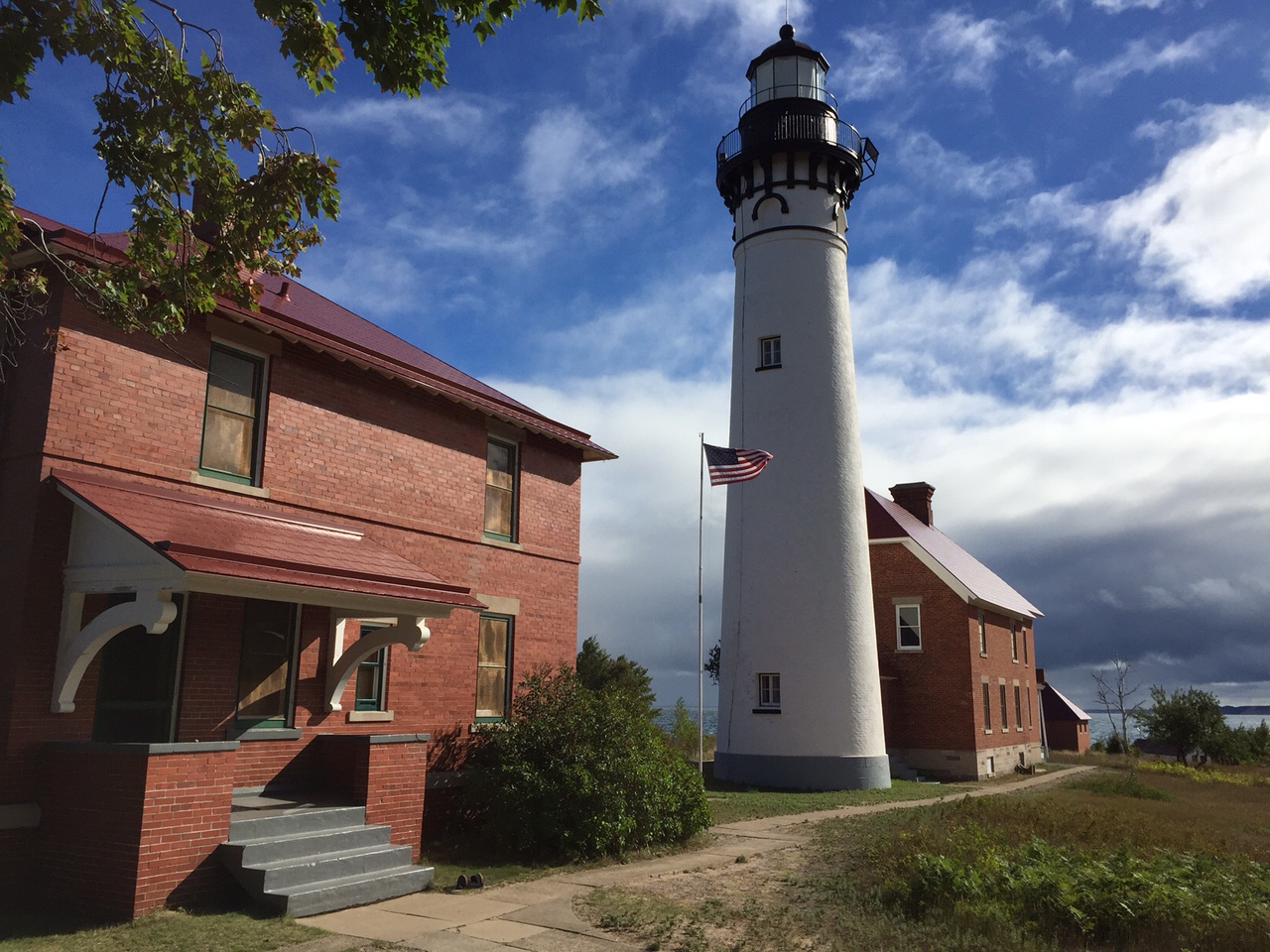
Au Sable Light Station
Au Sable Lighthouse and light keeper's quarters
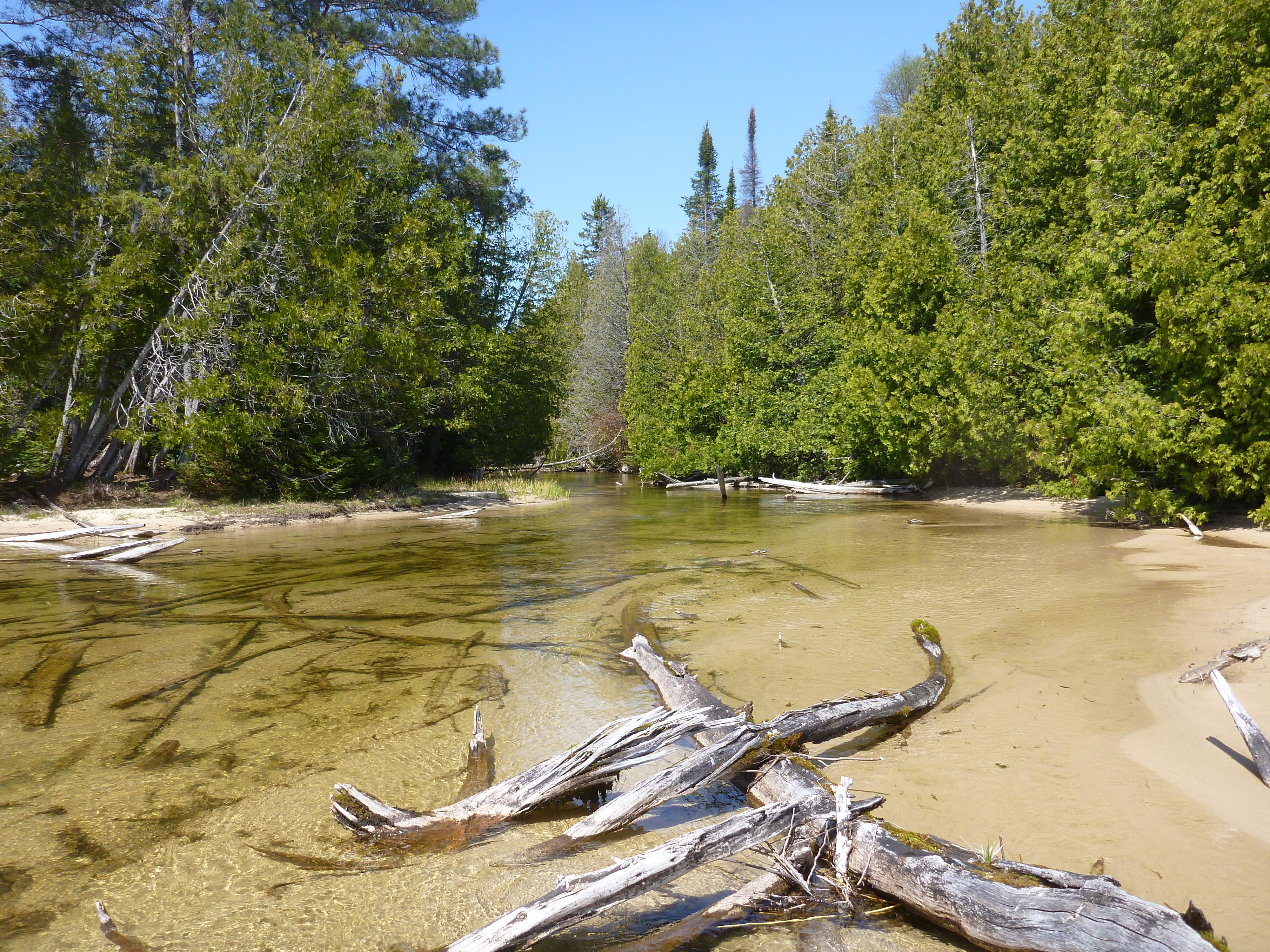
Beaver Basin Wilderness
Shallow creek in the Beaver Basin Wilderness
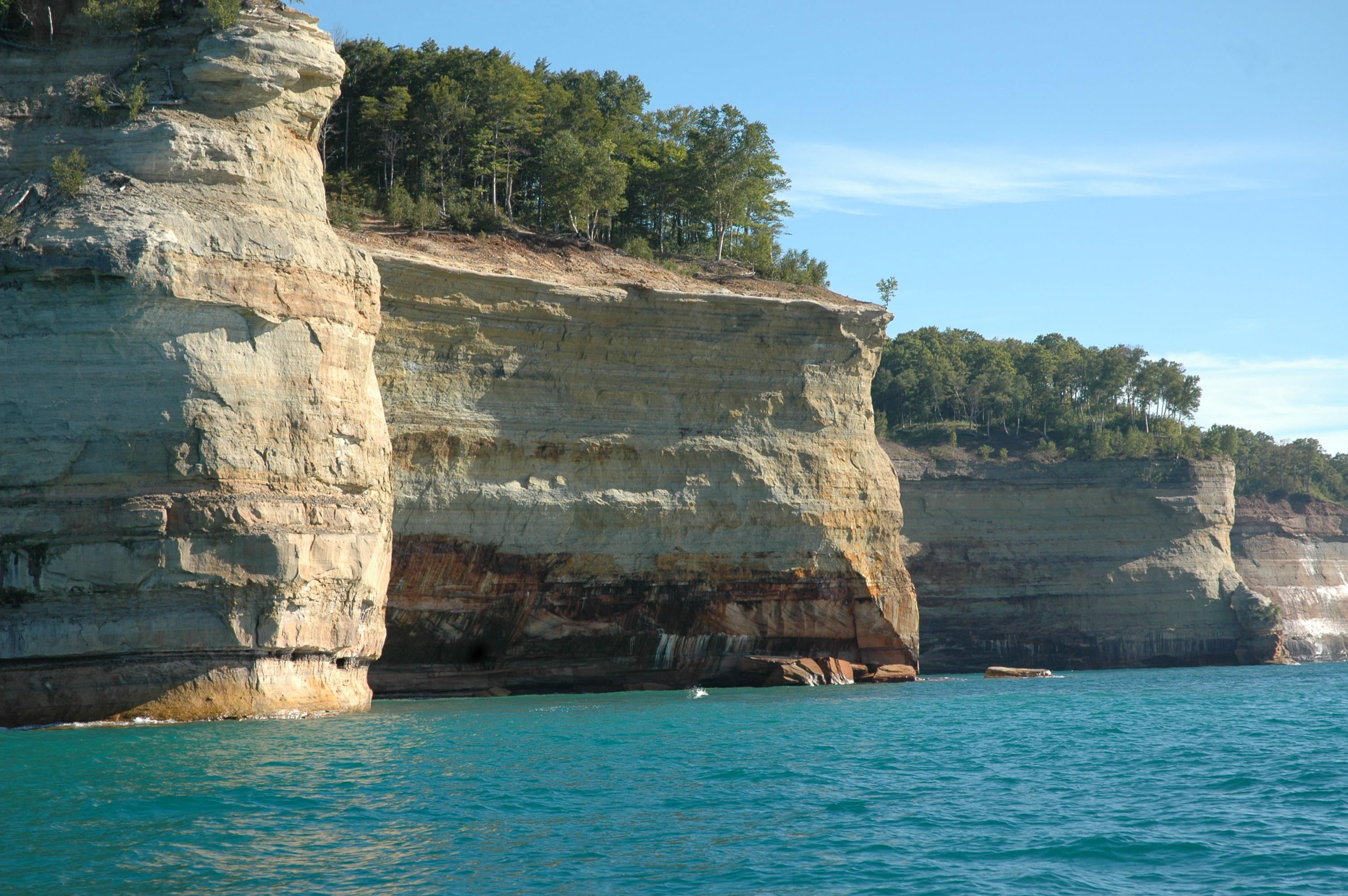
Battleship Row
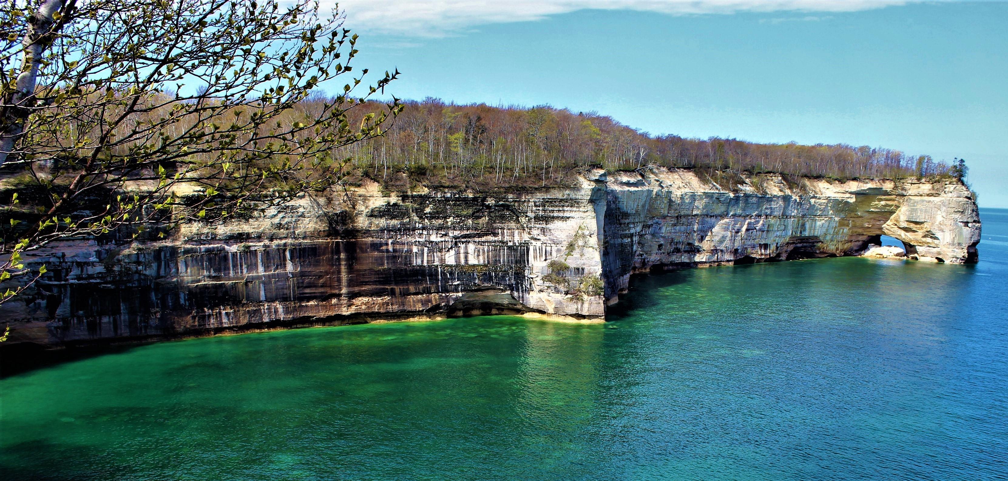
15 miles of carved and colorful cliffs along the Lake Superior shoreine.
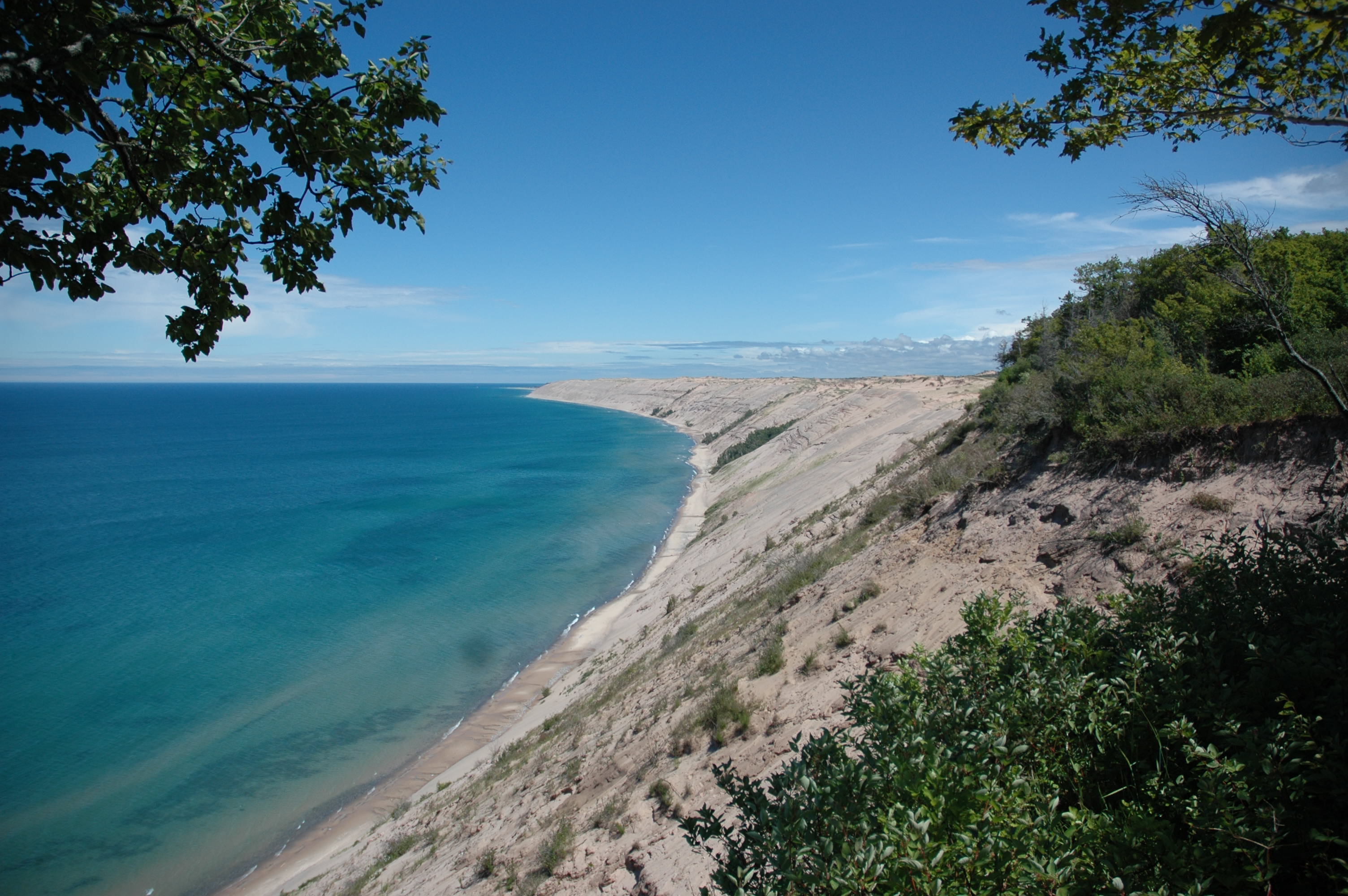
Grand Sable Dunes
The Grand Sable Dunes rise up 300 feet from Lake Superior.
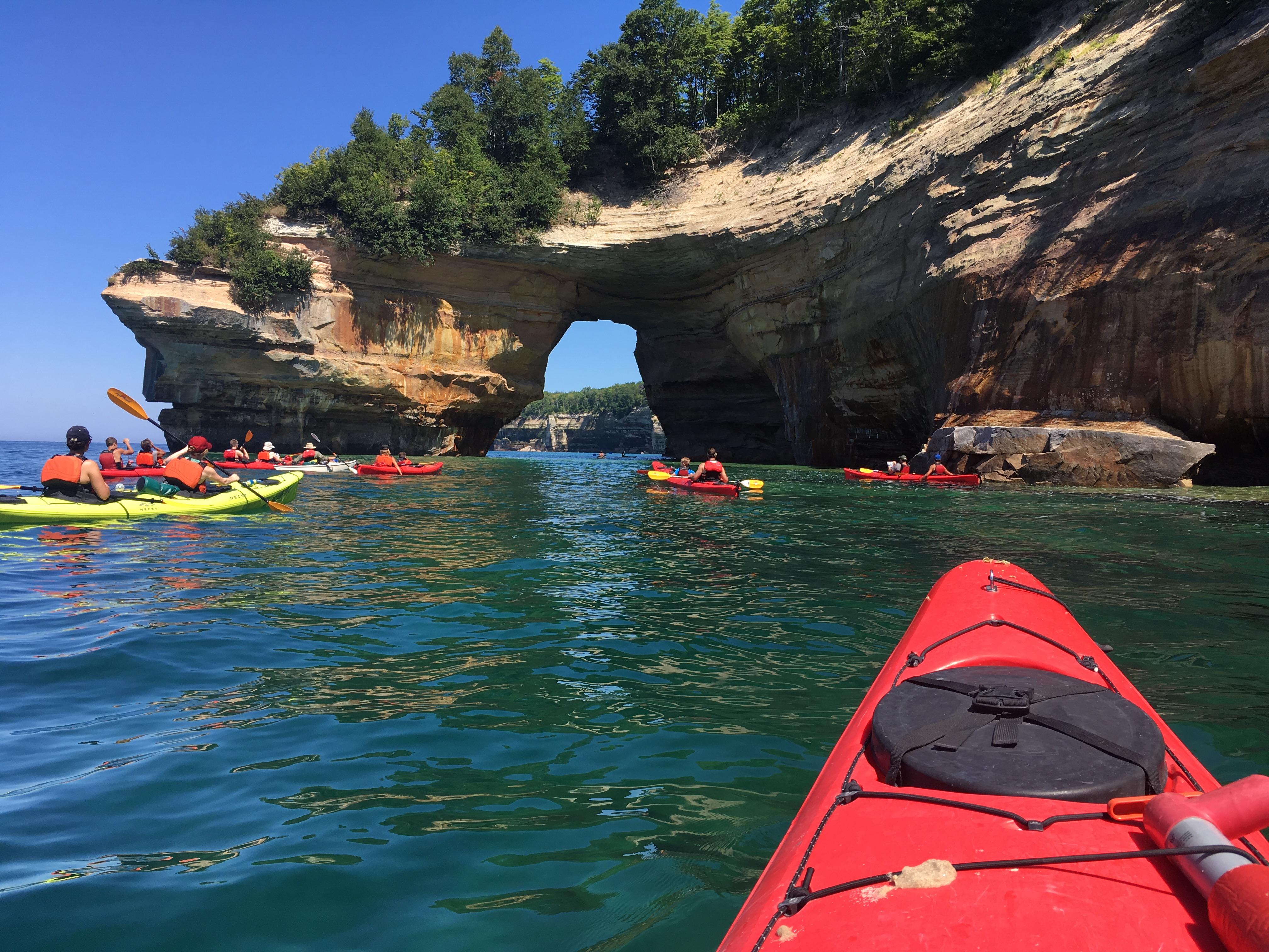
Kayaking Along the Pictured Rocks Cliffs
Kayakers near Lovers Leap
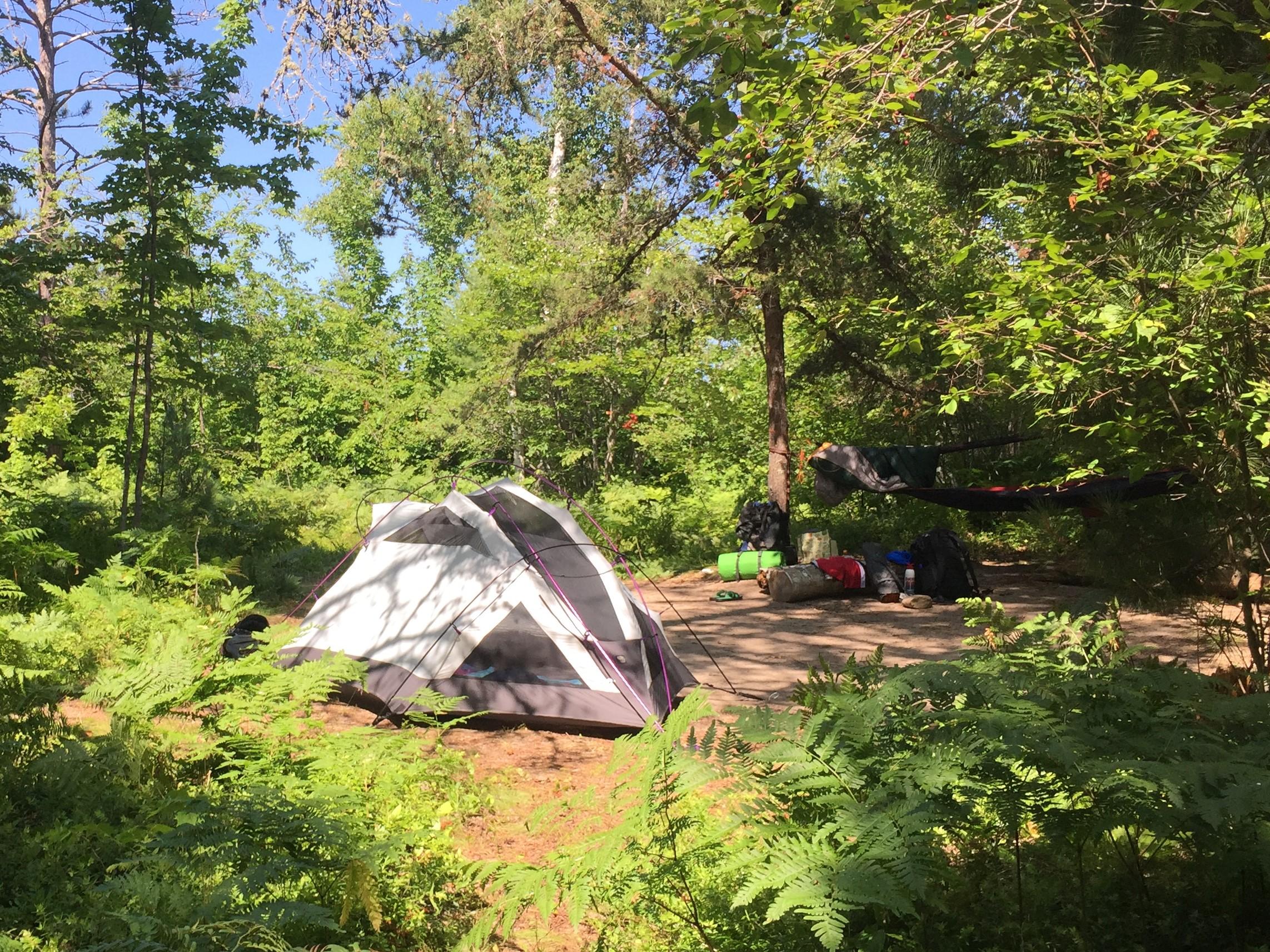
Backcountry Camping - Benchmark Site
Backpacking and camping are a popular activities.
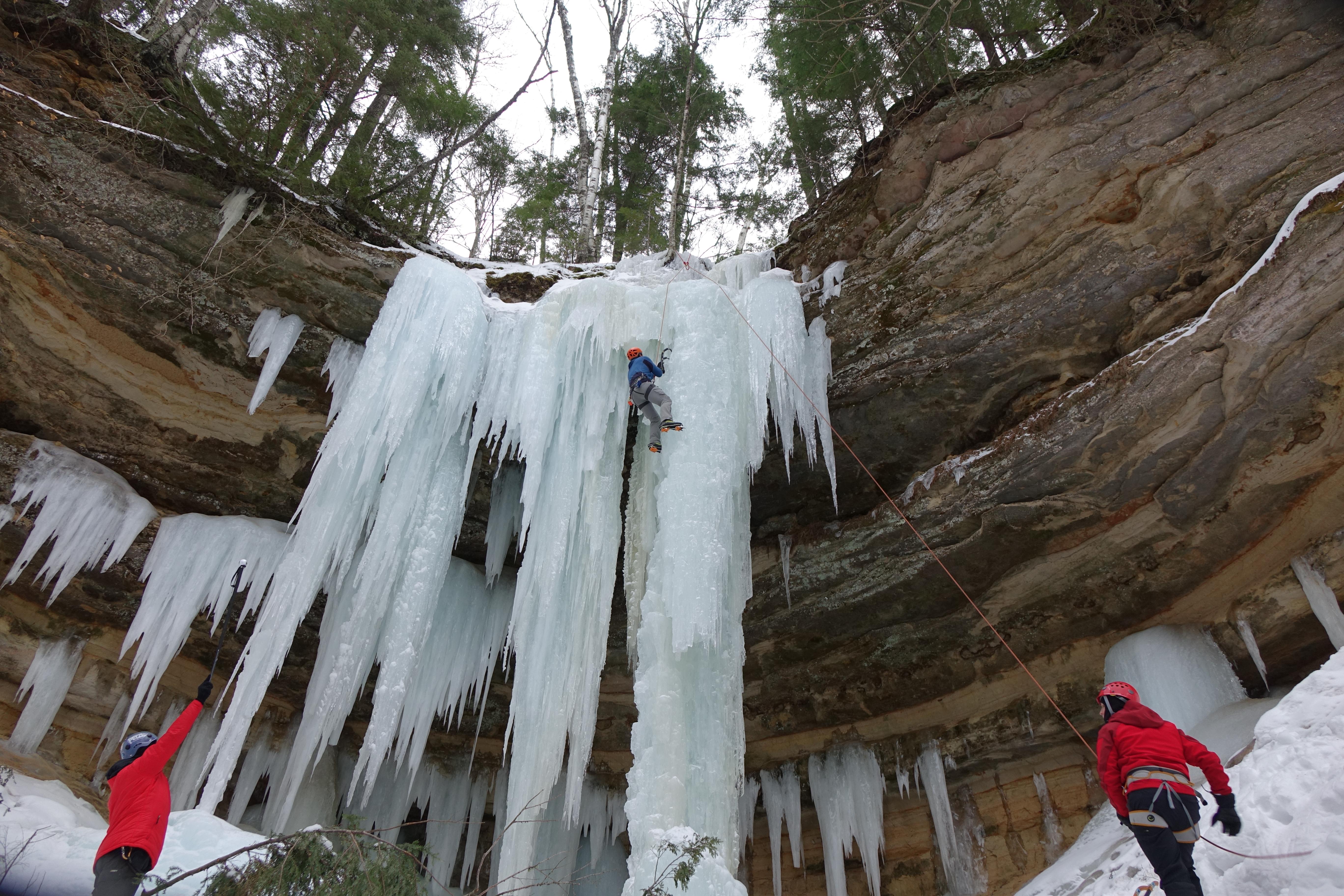
Ice Climbing
Ice climbing is a popular winter activity.
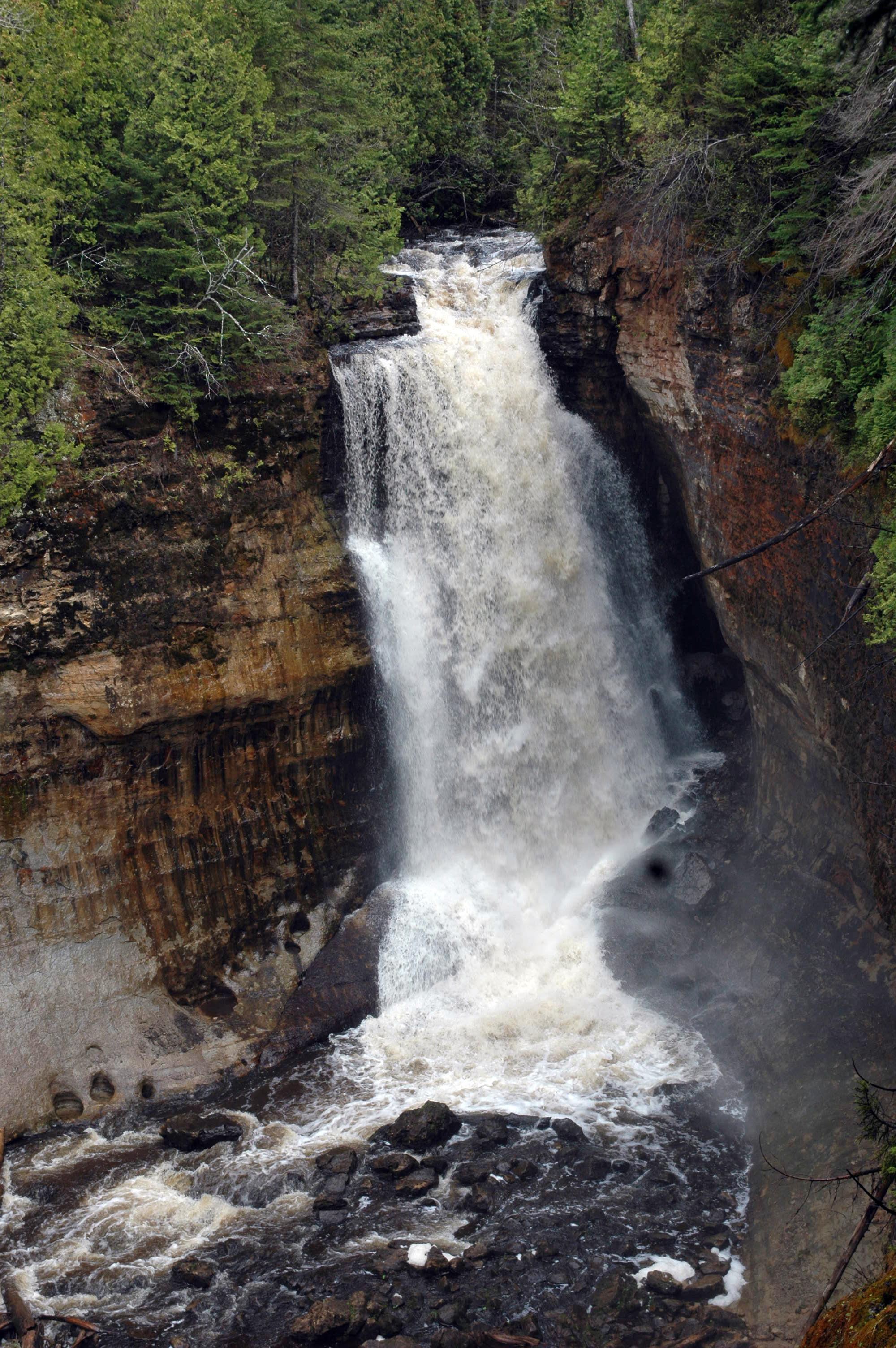
Miners Falls
Water flowing over Miners Falls
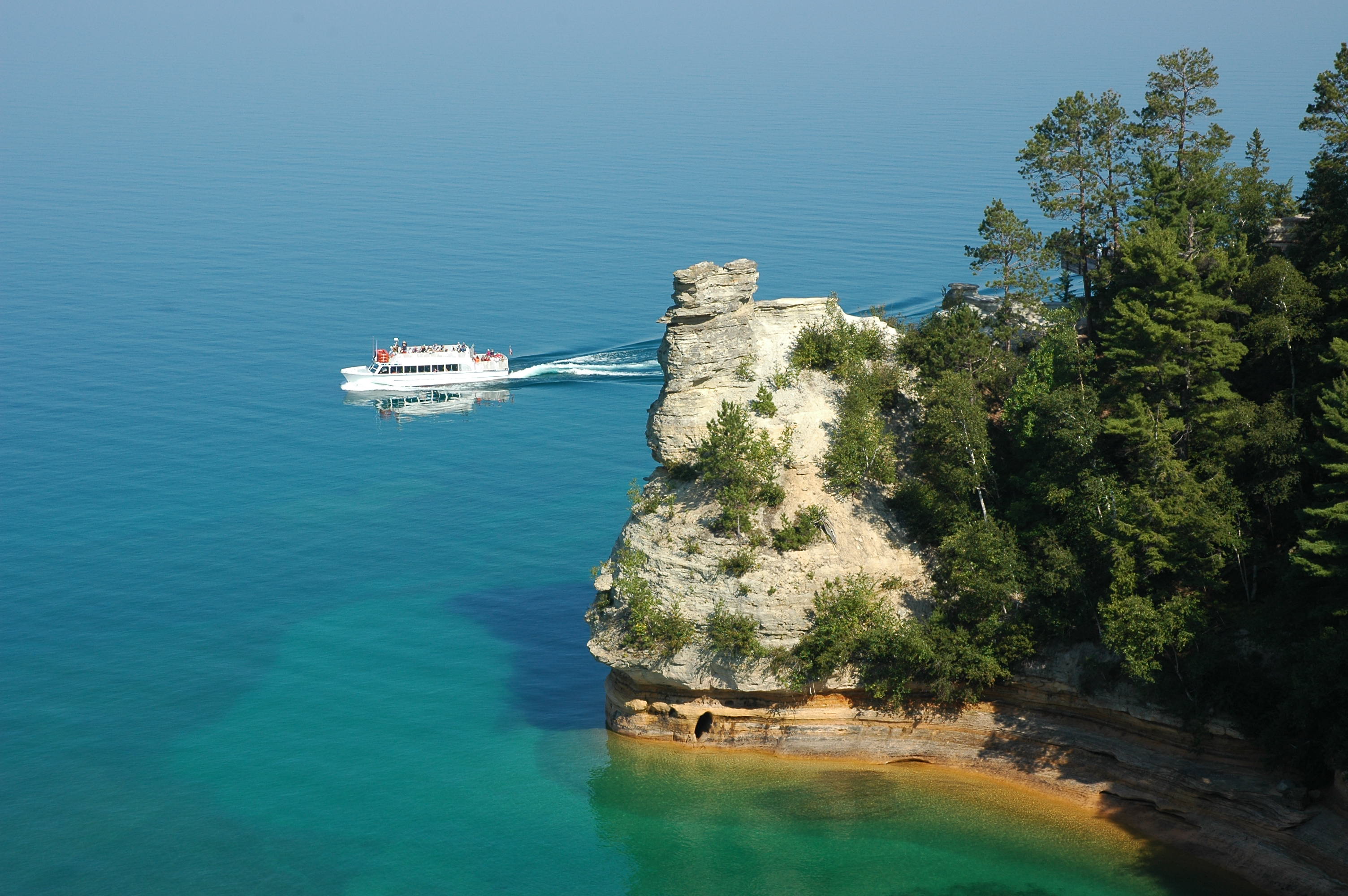
Miner's Castle
View the Miner's Castle rock formation from the adjacent cliffs or from a boat.
Pictured Rocks Cliffs along the Chapel / Mosquito Loop
Springtime along the Chapel / Mosquito hiking loop